
We had conducted another field surveys in the Philippines, as a follow-up project. We visited Tacloban in the Leyte Island, where we could not visit last September due to the typhoon, and San Francisco in the Camotes Islands, where there were no casualties at the time of Typhoon Yolanda.
[In Tacloban]
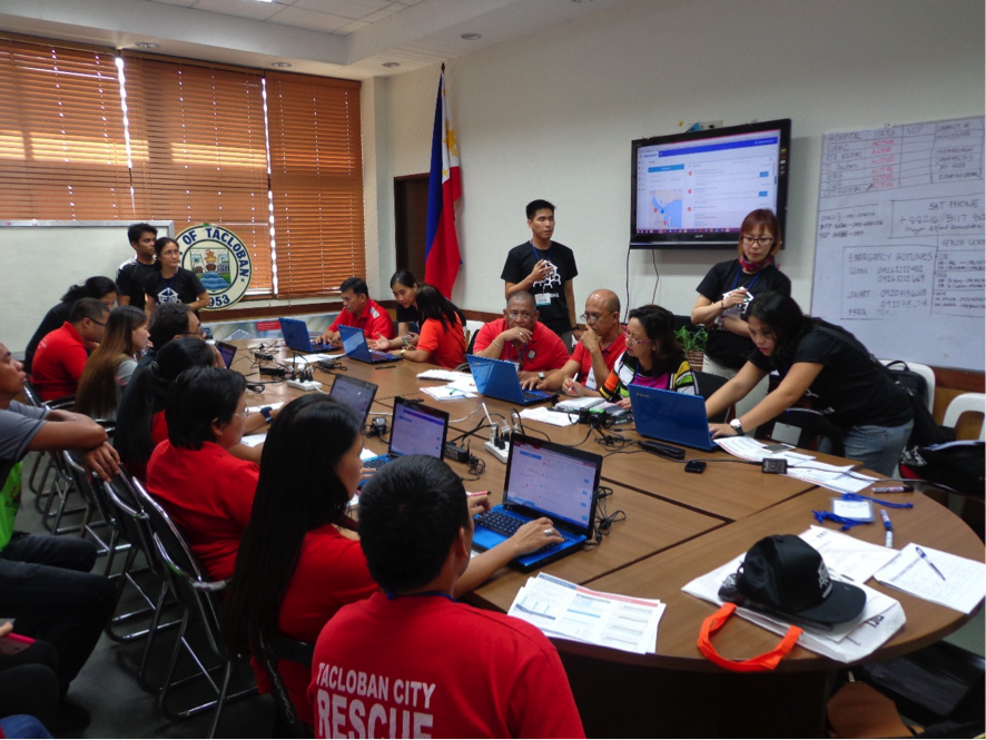
We have been developing with members of the Ateneo de Manila University an application for gathering disaster information which was tested for verification for disaster countermeasures at the headquarters, located next to the Mayor’s office in the City Hall. A mock disaster countermeasures headquarters was set up involving the Mayor, the officials from the health sector, the rescue teams and regional volunteers, and then a simulation was conducted using the disaster scenario based on Typhoon No. 30 (Yolanda) that had occurred two years ago. The drill for the visualization of evacuation shelter conditions was conducted. Furthermore, we listened to the Mayor of Tacloban talk about the shelter conditions at the time of the occurrence of Typhoon Yolanda. We had learned about the difficulties in gathering information and the vulnerability of the information infrastructure. We also realized that the establishment of an accurate information collection mechanism was important for the future.
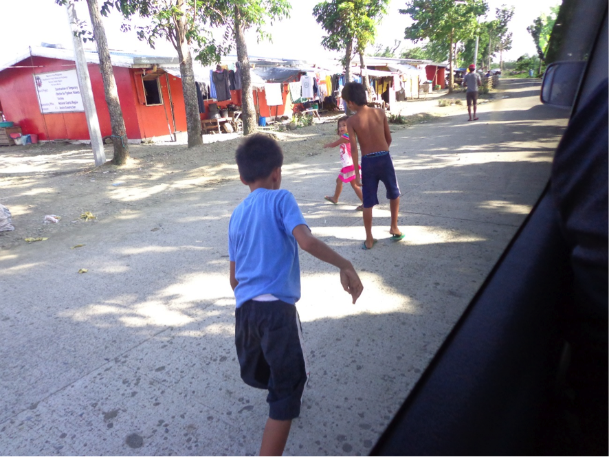
We had the opportunity to visit the temporary housing facilities for people who had lost their homes from the Typhoon Yolanda and interviewed them about their living conditions one year after the typhoon. People mentioned that immediately after the typhoon, there were security issues arising from large-scaled damages and confusion, but afterwards they were able to move into the shelters, and as a whole of the community, they did not face such major problems. This made us realize the importance of a community. Also, even after the relocation, there were occasional visits by overseas medical care teams, so they did not feel much anxiety about their health. They had no idea until when they would have to stay in temporary housing facilities, but the bright and smiling faces of the children there made a strong impression on us.
<San Francisco city, Camotes Island>
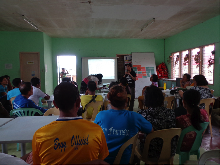
In San Francisco City in the Camotes Islands, located in the southwest of the Island of Leyte and in the East of Cebu Island, the town had been developed with the active involvement of the leaders of barangay (a small administrative division akin to a ward in Japan) even before the Yolanda Typhoon. At the time of the Yolanda Typhoon the evacuation actions were effectively taken based on the information obtained from each settlement. We had an opportunity to listen to the Mayor who had actually initiated the actions. He emphasized that it was important to have a simple town planning focusing on the ease of living and security. This strategy would also be useful during times of disasters. In addition, the Mayor pointed out the importance of knowing the related risks and the vulnerability. We felt that Japan could learn a lot from this case study and were reminded that it was important for each country in Asia to learn together since the region is prone to multiple disasters.
DNGL Miho Morosawa & Megumi Nichigawa, University of Kochi